Filed under: Words of the Months
Definition: The political state, traditionally consisting of seven kingdoms, that what is now England was in until Wessex took over (possibly in 829 A.D., no one seems to agree on when the period ended.)
Etymology: Greek ἑπτά hepta, seven and ἄρχω arkho, to rule. Analagous to monarchy.
The Heptarchy consisted of the kingdoms of East Anglia, Essex, Kent, Mercia, Northumbria, Sussex and Wessex. However, some of these, notably Northumbria, contained sub-kingdoms with some degree of autonomy. Additionally, at several points in history, one or another of the kings achieved dominion over part or all of the island.
Today, shades of the Heptarchic kingdoms remain in the names of some English counties, such as Essex and Kent.
Please let me know if there are any words you would like featured by posting a comment on this post.
Filed under: Recreation
Saturday
On Saturday (4/17) we decided to do a more strenuous hike, as we were more fully recovered from our late night drive into Grand Canyon on Thursday. So, we took the Grandview Trail from Grandview Point, which, back at the turn of the last century, hosted a hotel called … wait for it… the Grandview Hotel. Not very imaginative nomenclature, if you ask me.
In the above photo, you can see Horseshoe Mesa, a bifurcated shelf of Redwall limestone, topped by an oblong butte made of very eye-catching Supai group mud- and sandstone.
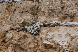
After passing the pretty flower above, we entered the Coconino sandstone, just like on the previous hike. An interesting feature of this rock, not seen in any of the other layers in Grand Canyon, is the presence of what is known as cross-bedding. Cross-bedding is where different layers of sedimentary rock lay in sometimes opposing directions. This is caused by the rock’s being formed in huge dunes, which every so often changed orientation.
At the point where we left the Coconino and entered the Hermit formation, there was this sheer cliff, the top two thirds being Coconino sandstone, and the bottom third consisting of the red Hermit shale.
A word on photos: many of the pictures I took turned out to be somewhat overexposed, but, by the magic of digital alteration, I can have my computer alter the exposure. However, I have attempted, as much as possible, to present you with these images in their original, unaltered format.
It took us a couple of hours to get down to the mesa, but I didn’t take all that many photos, and most of those I did take were of more botany and geology, so here we are.
After a satisfying lunch amid the glory of the canyon, we headed back up the trail, no small feat considering we had to go over four and a half kilometers across and 750 meters up to return to our starting point.
Sunday
On Sunday (4/18), as we had just done two pretty serious hikes in a row, we decided to forego any unnecessary walking and take the bus west along the South Rim. I took very few pictures, however.
(I’m afraid the retouching of the above photo had little to no effect on the background.)
And that concludes my April 2015 travelogue. See you next Monday with something with less images!
Filed under: Recreation
Click here for Part Two.
After we left the Mojave Desert, we drove east into Arizona to… Grand Canyon, one of the most spectacular, enormous, overused, and clichéd geological features this continent has to offer. We got there Thursday evening (4/16), and started hiking on Friday (4/17).
Friday
Our first hike of the weekend was on the South Kaibab Trail, which, along with its brother the North Kaibab, makes up a sort of corridor between the North and South Rims of the canyon.
We descended from the South Rim (Yaki Point) end of the trail. It was pleasantly cool on the rim, a nice change from the heat of the Mojave Desert.

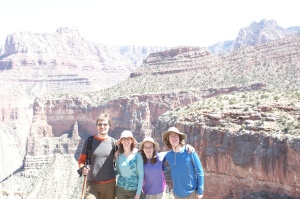
The view from the rim with Dad, Winnie and Mom.
We descended past the Kaibab and Toroweap limestone formations, and into the Coconino sandstone formation.
We then descended into the red Hermit Shale formation, and stopped at its boundary with the Supai Group formations to eat lunch.
After that, we continued down the trail to below O’Neill Butte.
Below the mesa the trail wound down to the Redwall Limestone, and from there would descend to the canyon floor. We, however, did not go anywhere near that far.
(In the centre of the above photo is a mule deer. It was considerably more courteous than its namesakes the mules, which left steaming piles of green at many points along the trail; the deer just ran away.)
That’s all for now. See you Thursday with Grand Canyon: Part Two!


